New Bedford Infrastructure Development (2023)
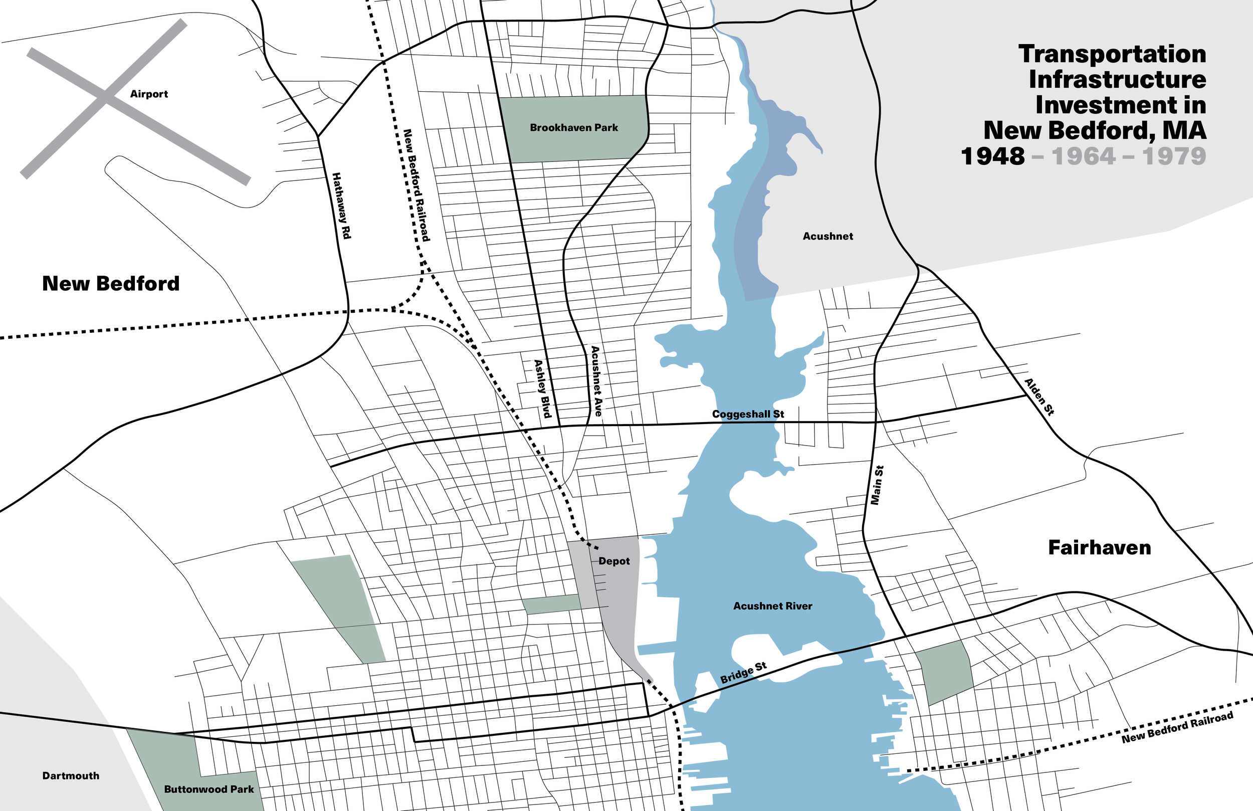
This mapping project, a precursor to a later partnership with the City of New Bedford, Groundwork Southcoast and the Envision Resilience challenge, studies the infrastructural change in downtown New Bedford through the 20th and 21st centuries, with a particular focus on transportation. The development of the I-195, Route 18 and Route 6 highway projects through the dense, historic core of the city has resulted in lasting consequences, namely a lack of connectivity between different neighborhoods and reliance on the automobile to travel through New Bedford. The first sequence of maps focuses particularly on roadway development, and the second sequence of maps focuses primarily on land use change and the reworking of built form with residential/industrial buildings and park spaces destroyed in the highway’s path. Over 30 blocks were completely demolished for Route 18 alone and an estimated 150 blocks were destroyed for all three highways and their interchanges. These maps were recreated using Bromley atlases, aerial photographs and the 1948 Metropolitan Highway Plan for Massachusetts.