A Landscape of Change: Land Use in Roxbury and Mission Hill (2022)
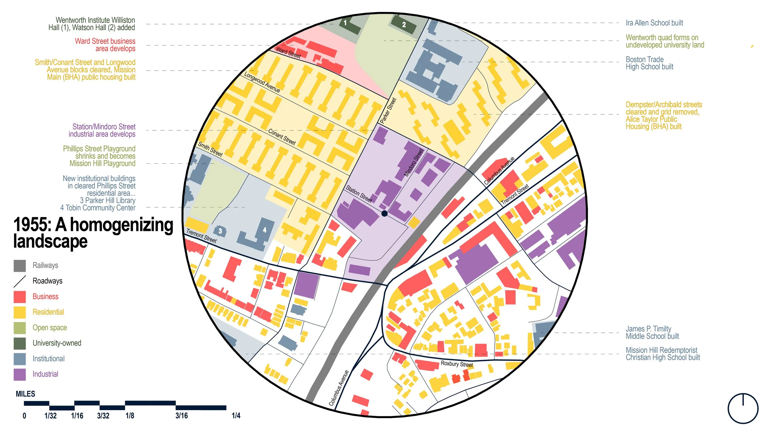
This interpretation and representation project is an attempt to understand the rapid, stark changes in land use in the quarter mile radius of the contemporary Roxbury Crossing MBTA station. Roxbury and Mission Hill are two Boston neighborhoods that have been deeply impacted by the consequences of urban renewal, redlining, arson, and public housing development which led to the homogenization of residential space. Overlaying historic maps, atlases, and aerial projections, I categorized historic structures through contemporary land use conventions from the 1930s, right after the implementation of Boston’s first zoning laws, through 2020. One can see a unified, diverse neighborhood across the Southwest Corridor become a landscape of single-use, sparse parcels as external forces destroy and wreck havoc on the area throughout the twentieth century. Conducting research for each parcel individually and calling out some of the key institutions that surround the station, I hope to highlight the movement of universities into the area, the repurposing of cleared land through urban renewal for a variety of civic buildings (and parking to support them despite the opening of the new Orange Line rapid transit line in the late 80s), and the usage of smaller plots of land, most likely building-clear due to rampant arson in the neighborhood, for gardens and other open space.